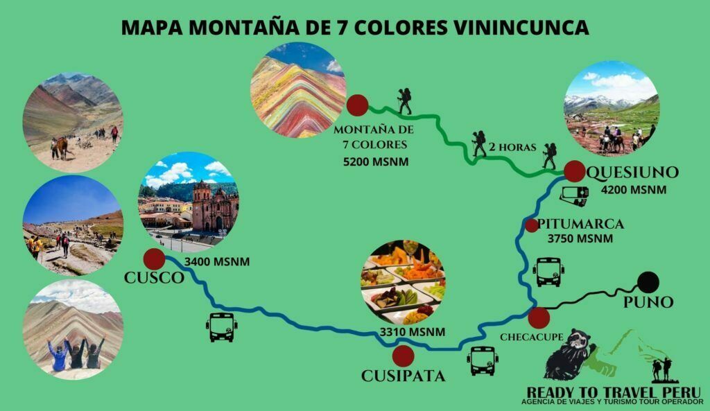
MAP OF THE MOUNTAIN OF COLORS VININCUNCA
In the following map you will be able to see the starting point that begins from the city of Cusco, with the next point that is Cusipata where generally is the place where the service of breakfast and lunch will be offered. Then we will pass through Checacupe to take the detour that will lead us to the district of Pitumarca to then drive us to Quesiuno, place where we will begin our walk of 2 hours approximately to arrive to our final destination that is the Mountain of 7 Colors of Vinincunca to 5200 m.a.s.l.

MAP OF THE PALCOYO COLORED MOUNTAIN
In the following map you will be able to see the starting point that begins from the city of Cusco, with the next point which is Cusipata where generally is the place where the breakfast and lunch service will be provided. Then we will pass through Checacupe to take the detour that will lead us to the community of Palcoyo where we will pay the entrance fee and head towards the Colored Mountain of Palcoyo at 4900 meters above sea level.


